POWERED BY PARTNERSHIP
RESEARCH & partner projects
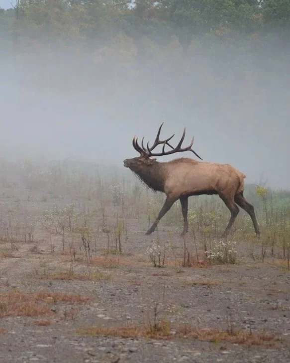
ELK & CORRIDOR Q
Collaborative study that identifies optimal locations for wildlife crossings and fencing along Corridor Q to protect elk, reduce crashes, and maintain habitat connectivity in Buchanan County.
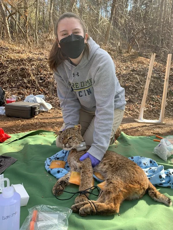
BOBCAT MOVEMENT ECOLOGY
Satellite tracking reveals bobcat movement patterns and preferred corridors between Charlottesville and Shenandoah, informing conservation strategies that protect diverse wildlife across Virginia.

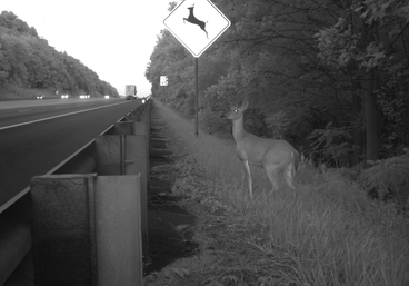
SOUTHERN ALBEMARLE MOUNTAINS
Citizen science and wildlife monitoring informed underpass improvements along Route 29, reducing collisions through Albemarle County's highest-elevation conservation focus area.
enhancing underpasses on i-64
Adding fencing to two I-64 underpasses west of Charlottesville transformed existing structures into effective wildlife crossings, dramatically reducing collisions while saving millions in costs.

LOUDOUN COUNTY project
Research partnership examining wildlife-vehicle conflicts in Loudoun County to identify collision hotspots, inform mitigation strategies, and improve road safety.

AFTON MOUNTAIN PROJECT
Collaborative project to reconnect wildlife habitat across I-64 at Afton Mountain by identifying priority crossing locations and reducing wildlife-vehicle collisions.

Wildlife Corridor Action Plan
Virginia’s Wildlife Corridor Action Plan reflects key leadership, with coalition members shaping development and adding expertise across conservation and transportation statewide.

Habitat Connectivity Hub
Virginia’s Habitat Connectivity StoryMap Platform highlights collaborative leadership and shared expertise to advance safe wildlife passage and reducing animal-vehicle conflicts statewide.
Photo © Lori A Cash Conservation Photography, LLC
CITIZEN SCIENCE & ANALYSIS

CITIZEN SCIENCE
Community volunteers documented wildlife collisions and corridor use, providing critical data that informed mitigation strategies and demonstrated project effectiveness.

Natural Landscape Assessment
Geospatial analysis identifies and prioritizes ecological cores, landscape corridors, and natural habitat networks to guide conservation planning and maintain connectivity across Virginia.
VSWCC Partners